Fresh scarps and runout, mapped across the whole survey region.
A dated landslide inventory layer from high-resolution satellite imagery after heavy rain or seismic shaking, ready for your GIS and your field verification plan.
Spec table
- GSD
- 0.5–2 m (high-res)
- Cadence
- event driven, one regional tasking per trigger event
- Platform
- high-res satellite
- Spectral
- RGB
- Coverage
- the survey region you define, not a single site
- Delivery unit
- scarp and runout polygons, dated
- Formats
- GeoPackage or shapefile
Files in the delivery
| File | Format | What's in it |
|---|---|---|
| Landslide inventory layer | GeoPackage or shapefile | Polygons for fresh scarps and debris runout across the survey region. Each feature carries the dates of the images it was mapped from, so the event date range is on the record. Every feature is a candidate for field verification, not a confirmed count. |
| Change comparison | GeoPackage or shapefile | Where a pre-event baseline image exists, the layer notes what changed against it. Where none exists, the feature is mapped from the post-event image alone and marked that way. |
| Image scene list | CSV | Which images were used, their dates and the part of the region each one covered. Gaps from cloud sit here too, so you can see what was not looked at. |
| Verification planning export | GeoPackage | The same features in a layer set up for planning field visits, so the crew can sort valleys by what was flagged before anyone drives out. |
How it works
01You supply
Send the survey region
Supply the boundary as a shapefile or GeoPackage, and tell us the trigger event and its date.
02We do
Tasked pass
A high-resolution satellite pass is tasked over the region after the event. If cloud covers the first pass, it waits for the next clear window.
03We do
Change detection and segmentation
Fresh scarps and runout are found by comparing the post-event image with the earlier baseline, then outlined as polygons.
04Comes back
Hand-over
The inventory layer, scene list and planning export arrive in formats that open in QGIS or ArcGIS, ready to load into your own landslide database.
Limits
| Condition | Effect on the delivery |
|---|---|
| Cloud after the trigger | Heavy rain and cloud arrive together, and an earthquake can be followed by a spell of bad weather. The pass runs on the first clear window, which can come well after the event. The scene list shows the date each part of the region was actually seen. |
| 0.5–2 m sets the smallest scar | At the coarse end, 2 m, a scar a few pixels across can be flagged but not typed or outlined with confidence. Small slides are the ones most likely to be missed. At 0.5 m much more resolves. |
| Vegetation hides scars | Thick canopy can cover a scarp and its runout. Slides under forest may show only where the canopy was torn open. |
| RGB only | Three visible bands. No infrared, no radar, no terrain model. Landslide type and depth are not read from the imagery, so type fields stay for you to assign. |
| Candidates, not a census | The layer flags what imagery signatures show. It will miss some slides and will flag some features that turn out not to be slides. Field verification is still the confirming step. |
| Event inventory only | It maps what a trigger event left behind. It does not predict where slides will happen next, and it does not date older slides. |
Why this exists
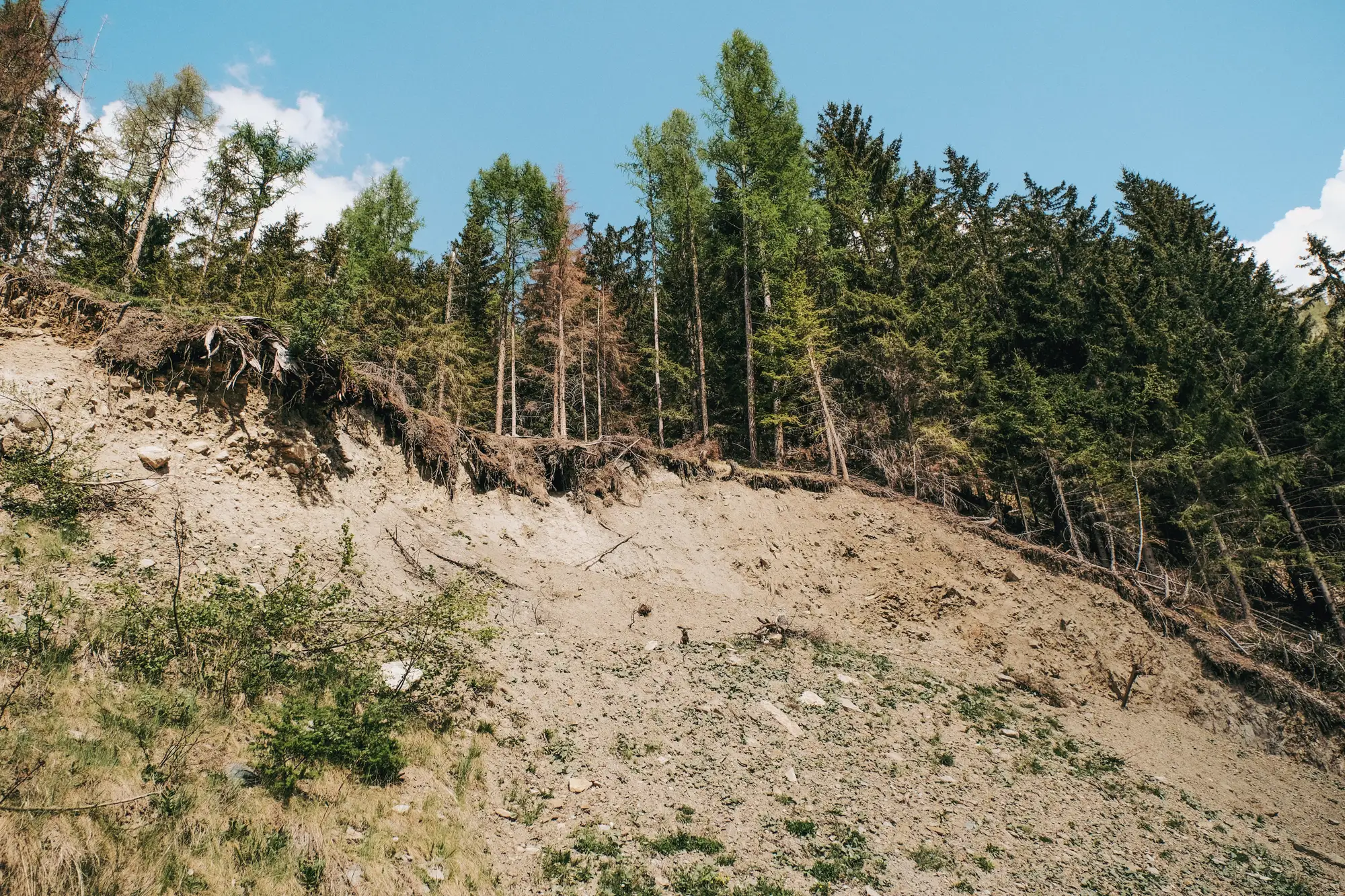
After the rain or the shaking, the inventory gets built tile by tile. Someone opens the archive imagery, pans valley by valley and traces each scar and runout by hand, then field crews check what road access allows. The survey area is bigger than the hours available, so coverage follows access and whoever looked first. Cloud can hold back the first usable image, and the hazard-map update waits with it. This service does the first pass over the whole region and hands you a layer to correct.
Who it's for
For
- Geological survey scientists compiling a regional landslide inventory after a rain or seismic trigger event.
- Geohazard teams that want a candidate layer across the whole region before they commit field crews to specific valleys.
- GIS staff who will load the polygons into the survey's own landslide database and assign type and confidence themselves.
Not for
- Teams that need landslide forecasts or hazard zoning. This inventories what already happened.
- Single-site slope assessments, where a drone survey or a geotechnical inspection does the job better.
- Emergency response that needs a map in the first hours. Optical imagery waits on clear sky.
- Teams after figures on harm to people or property. The layer maps ground features only.
Technical and procurement questions
Does this find every landslide?
No. It flags candidate fresh scarps and runout from imagery signatures. Field verification is still the confirming step.
What about cloud cover after heavy rain?
The pass runs on the first cloud-free window, which can lag the trigger event. The scene list records the date behind every part of the layer.
Does 0.5–2 m catch small slides?
It resolves scarps and runout at that scale. Very small slides, or ones under thick vegetation, may not show clearly.
Does it predict where landslides will happen next?
No. It detects and inventories what has already occurred.
Can it cover a whole region after one event?
Yes. That is the intended scale: one trigger event, one regional tasking over the boundary you supply.
Will the polygons fit our landslide database?
They load as ordinary polygons in QGIS or ArcGIS. Tell us your attribute schema when the region is scoped and we will say which fields the delivery can fill. Landslide type and confidence are usually yours to assign.
How do we check it against our own mapping?
Compare the layer with your field-verified slides and any earlier inventory for the same event. The image dates on each feature let you match them to the right pre- and post-event conditions.
Who owns the layers you deliver?
Use and ownership terms for the delivered layers are set in the contract before work starts. The satellite imagery providers keep their own licences.
How is it priced, and how do we buy it?
Each region is scoped and quoted on its own, from its size and the event. You get a written scope you can take through your survey's procurement.
Send us the survey region and the trigger event.
Ask in the chat what the inventory would hold for your region.